To NL’s South Coast! Yes…What a trip!…
Friday, August 1st
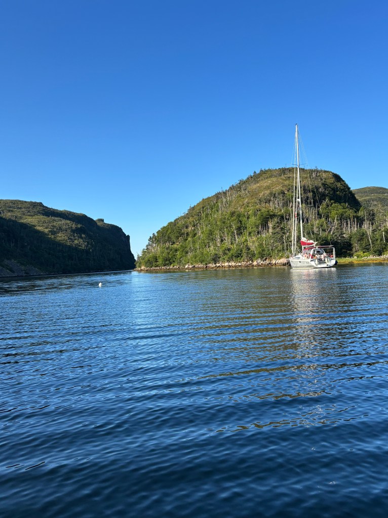
Soon out of St.John’s Harbour, watching tankers and dodging fishermen, we settled in to motor 15nm south to the Witless Bay Nature Reserve. Forty minutes later, two humpback whales 400m off were breaching –slow, majestic arcs and huge splashes! We just stared in awe. We decided to hug the shore as we passed through the Witless Bay Area, as it is an ecological preserve and bird sanctuary. The areas islands are covered in rookeries – there were Seabirds everywhere! Ali was glued to the binoculars, tried her hand at photography – not!.. moving objects from a moving boat – did not work. Saw Puffins, Gannets, Kittwakes, Guillemots, Razorbills, Eagles, Osprey, Shearwaters.
Wind remained on the nose but light, with gentle seas, so we motored happily south under a clear blue sky. Despite our dislike of motoring, this shore usually has a strong southerly wind, which would be outright miserable, so motoring in the calm was a relative pleasure.
The temperature got cooler – wearing toques, boots and fleece. The coastal scenary is spectacular, especially if you like rocks (Steve did his BSc in Geology)! This is a painters paradise made more exquisite in the evening light. A pod of humpbacks were playing inshore, tails, fins and snouts appearing.
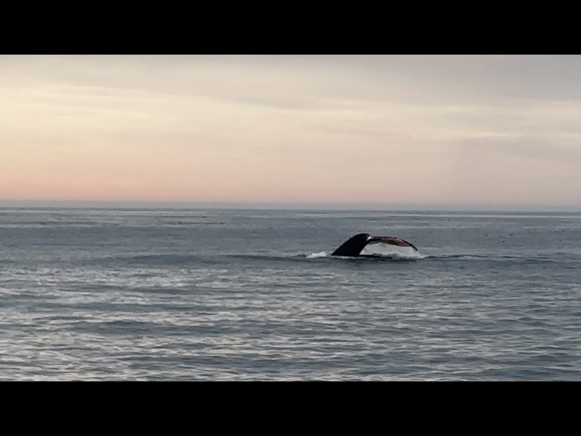
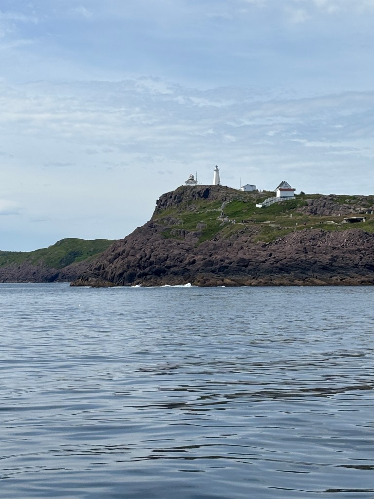
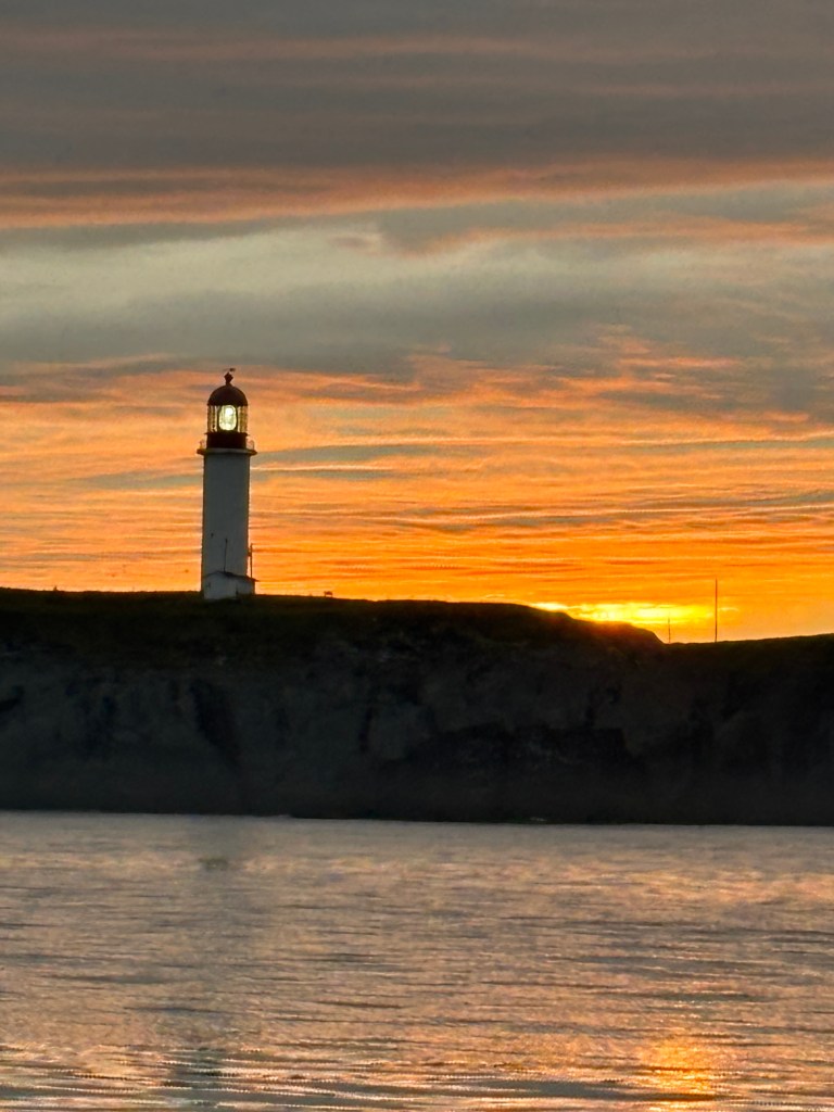
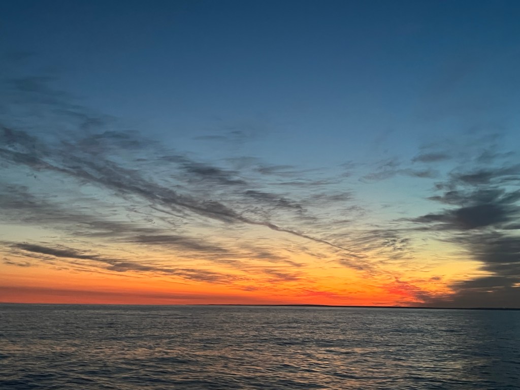
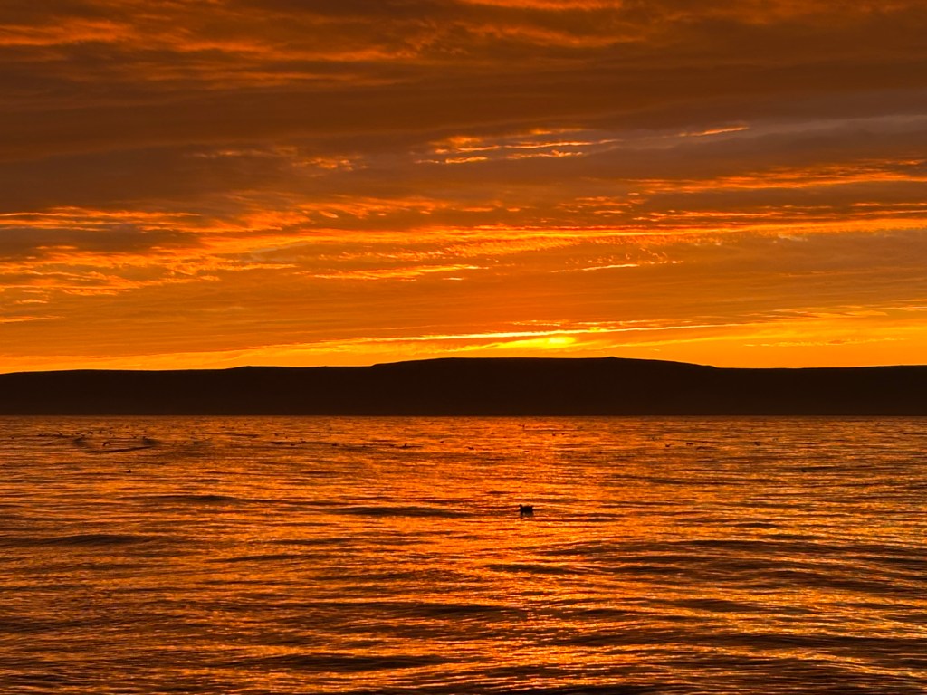
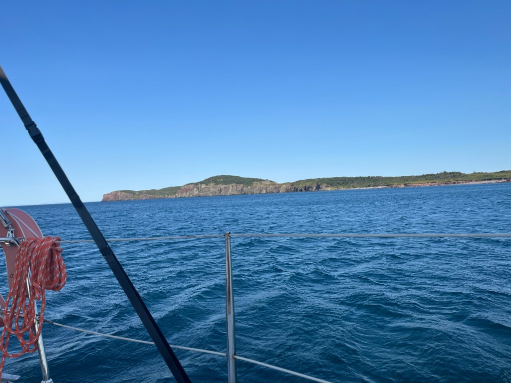
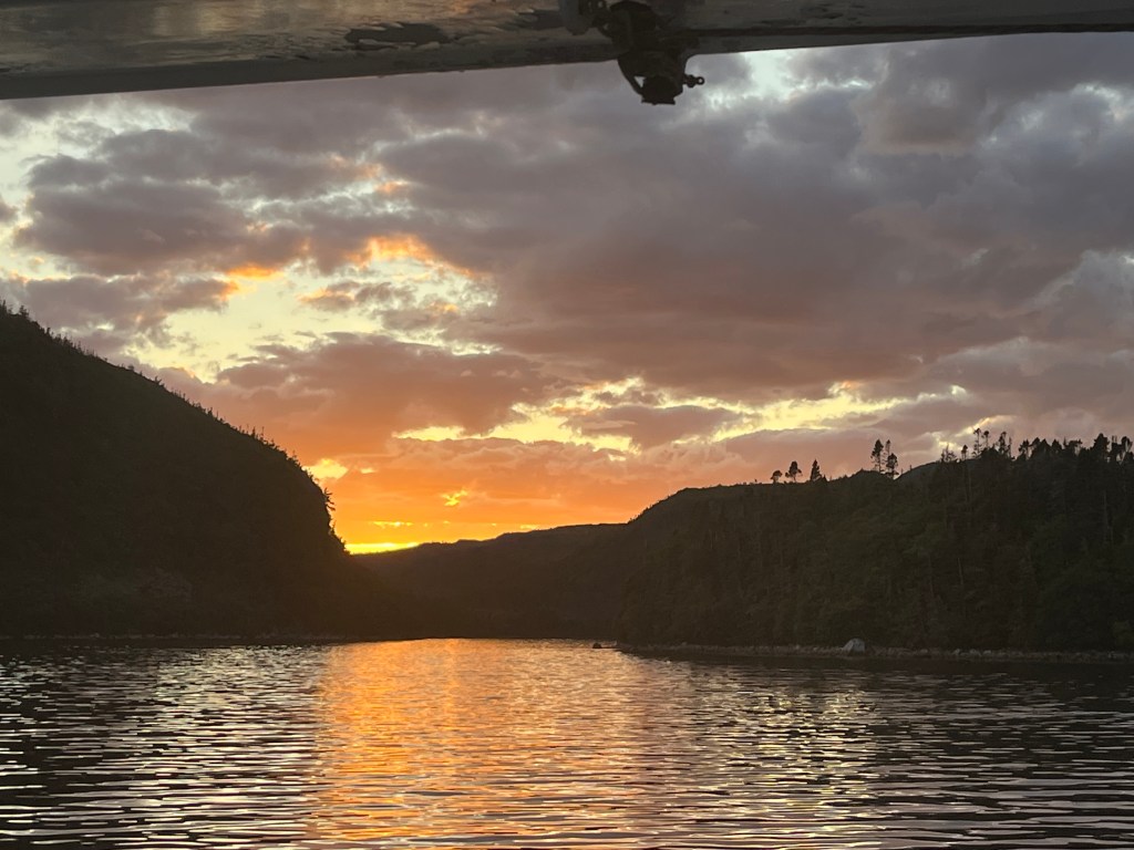
Cape Race is the southern most point and near the confluence of the Labrador current and the Gulf stream. We approached it at sundown which made it even more magical. Huge flocks of seabirds were out, and Tikaani plowed through them so there was lots of flapping and ‘walking on water’. We were mesmerized by the setting sun, but Ali turned around and “Cripes” – 6 humpback whales within 100ft. We slowed the boat down, until they got a little too close… getting bumped by a whale is not a ‘love tap’ – with 2 rudders and a keel, we did not take the chance. At dusk, around the Cape while going over a 20m shoal, we saw a smaller vertical dorsal fin and vertical tail fin which suspiciously looked like a shark just 20 feet off… yup – an ~8ft Blue Shark followed us for 2 minutes – yes, they do inhabit these cold waters! The sunset was epic and we had light right through to 10pm as we set up the watches. Midway through the night the skies cleared and stars danced. 4:30am is nautical dawn, another gorgeous pink/orange sky. This time the Dolphins visited at 6am – a large pod jumping and splashing – happy dolphins – with some breaking off to play with Tikaani.
There is something truly magical about sailing through the night, about dusk and dawn on the water.
Saturday, August 2nd
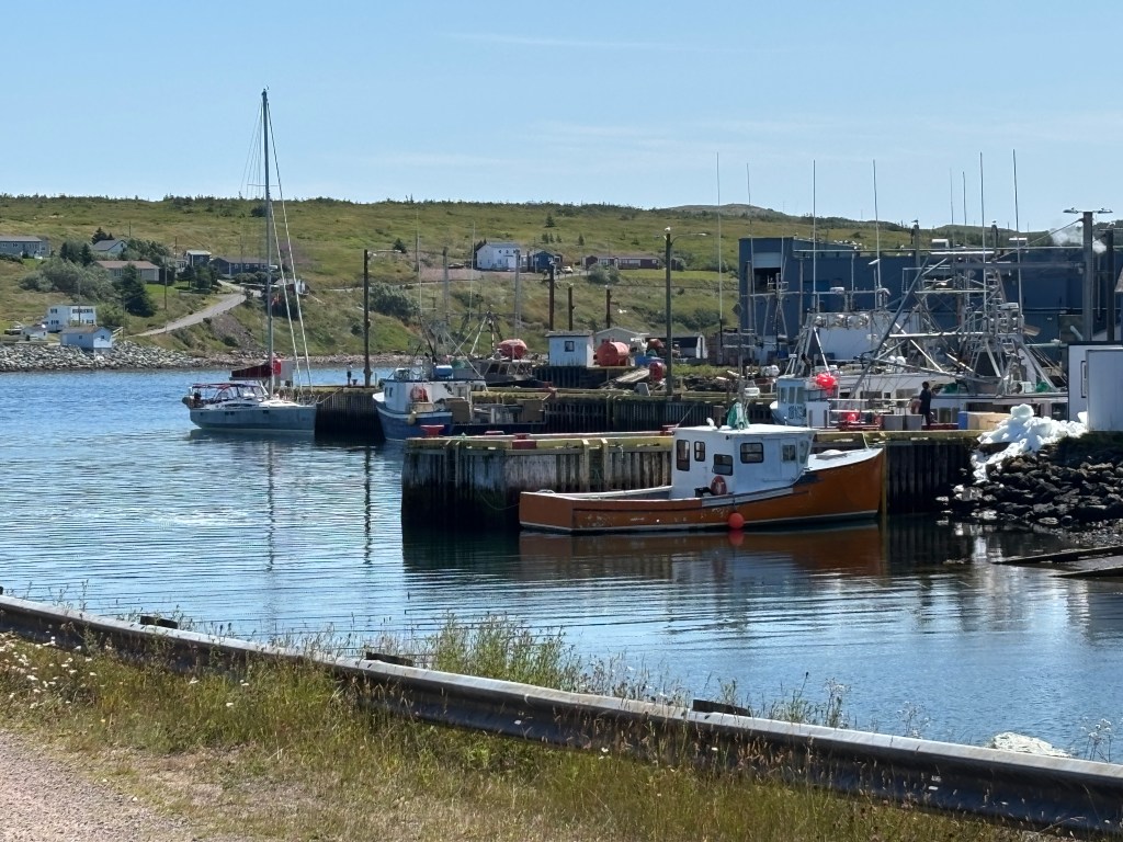
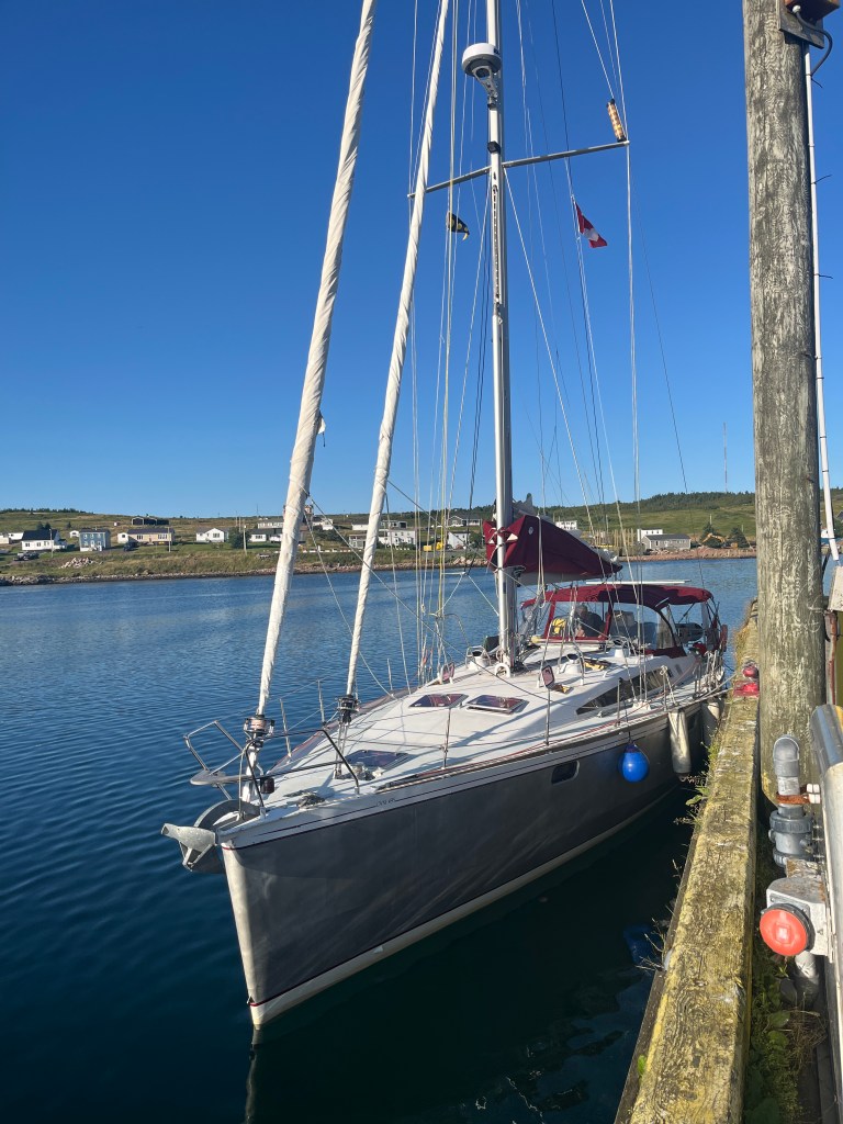
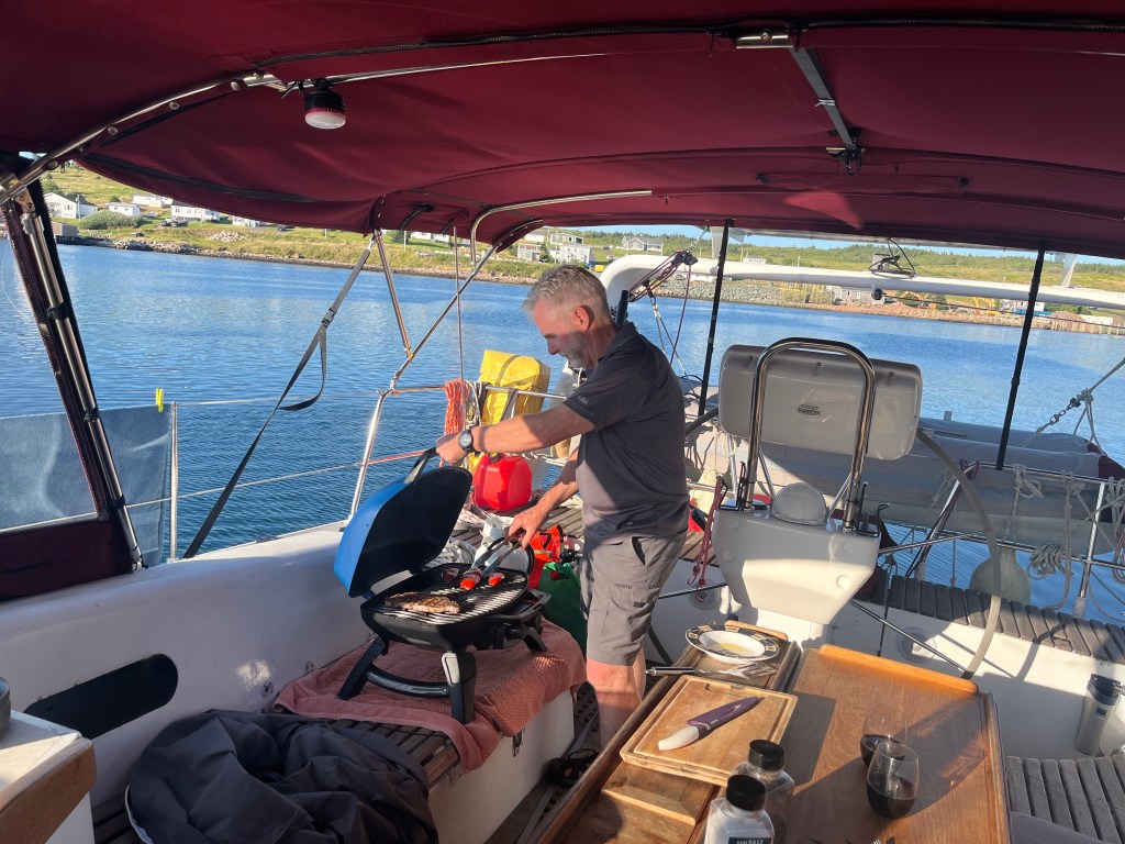
We arrived at St.Lawrence on the Burin Peninsula at 11am and found a spot on the government wharf, sharing with fishing boats… and you could smell the fish as the plant was 100ft away! It was “St.Lawrence Day” with a parade, kiddie corner and speeches! A walkabout town, talking to locals, blue sky, warm sun, lunch on Tikaani and we were ready for a nap. Two other sailboats arrived later, USA origin, checking in from St.Pierre et Miquelon – one was a boat delivery with 2 crew = girl power! Steve was adopted by the local kids as the ‘Dad on the wharf’, tying lures, providing new lures, loaning fillet knives, clearing tangles. This got noticed and next thing, one of the parents came down and gave us a pound for frozen scallops!
For history buffs, the Giller Award winning book “The Wake” by Linden Mcintyre is a good history of the Burrin Peninsula following the tsunami of 1929, which nearly wiped out the Peninsula, and destroyed the local cod fishery.
Sunday, August 3rd
Early the next morning, we were able to sail around the Burin Peninsula with a 15- 20 kts and aimed Tikaani Northeast towards the south shore. Our original intent was to do a long day sail across Fortune Bay to one of the southern fjords, but having recently done an “all-nighter”, our lazy gene kicked in and we split the trip in half, anchoring at Brunette island in the middle of the Fortune Bay. The wind was a healthy 20 kts out of the southeast so we found a large bay on the northwest side of Brunette with 8m depth and sand/mud bottom. The wind still whistled through the saddle of the island but we were sheltered from the fetch and the bay was calm. Rissotto and scallops for dinner!
Monday, August 4th
Next target was Sam Hitches Harbour in Bay D’Espoir. 20+kt wind meant reefed main and genoa and still making 8kt speed.
In NL, the changing topography is astonishing. The Avalon Peninsula was steep 200 foot cliffs and rocky shores and forests/greenery lining the top of the cliffs. The Burin Peninsula is flatter rolling hills and grassland with cobble beaches on the shore…almost pastoral. Then there is the south shore, with it’s 1000 foot vertical cliffs, fjords with depths of 200m and waterfalls big and small.
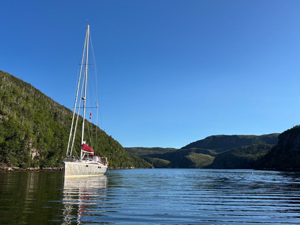
We motored to the top of the fjord but the charted depths for Sam Hitches Hbr were off with 10m, it was 30m depth. It was a beautiful but small Bay – deep and steep, making anchoring challenging. We circled looking for a spot that wasn’t 2m from shore and we had to avoid an aquaculture buoy (just one). We found a shallow ledge ~13 m depth just off the west shore and Steve reluctantly dropped the anchor lying parallel to the shore and a boat length away from shore. This was not ideal but the forecasted winds were light until morning when they would circle. To provide a little more security, we ran a secondary anchor (a Danforth) off the starboard stern to keep the boat off the shore. It worked, and we enjoyed a quiet night.
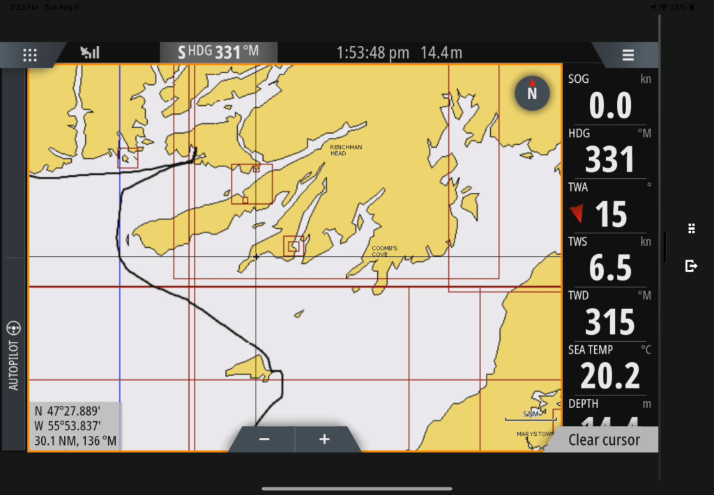
Tuesday, August 5th
Early the next morning (before winds changed) we had tea with the seals and dinghy’d around the bay. Winds would not allow us to stay in this small fjord and as we recovered the secondary anchor, the stern started swinging into the shore, 2m and too close for comfort…thank heaven for steep and deep shores. Careful extraction was a ‘dance’ between the windlass pulling up the anchor and the helmsmen steering away from shore. Lots of sphincter tightening but it worked!
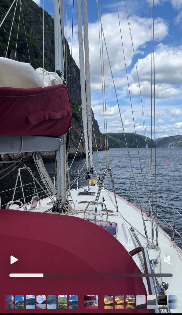
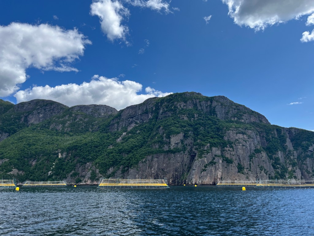
Winds were light so we motored the 22nm to our next target of Sandy Point in Hare Bay, a fjord about 5nm long. As we turned into Hare Bay fjord, depths 150m, a large aquaculture facility occupied much of the fjord. We had 20m between the west cliff face and their perimeter buoys in 26m depth.
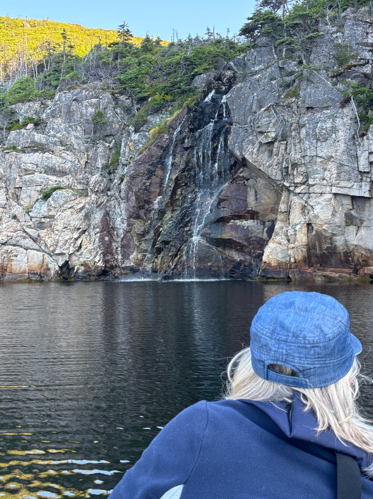
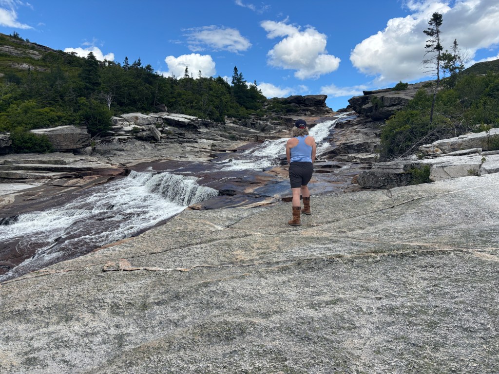
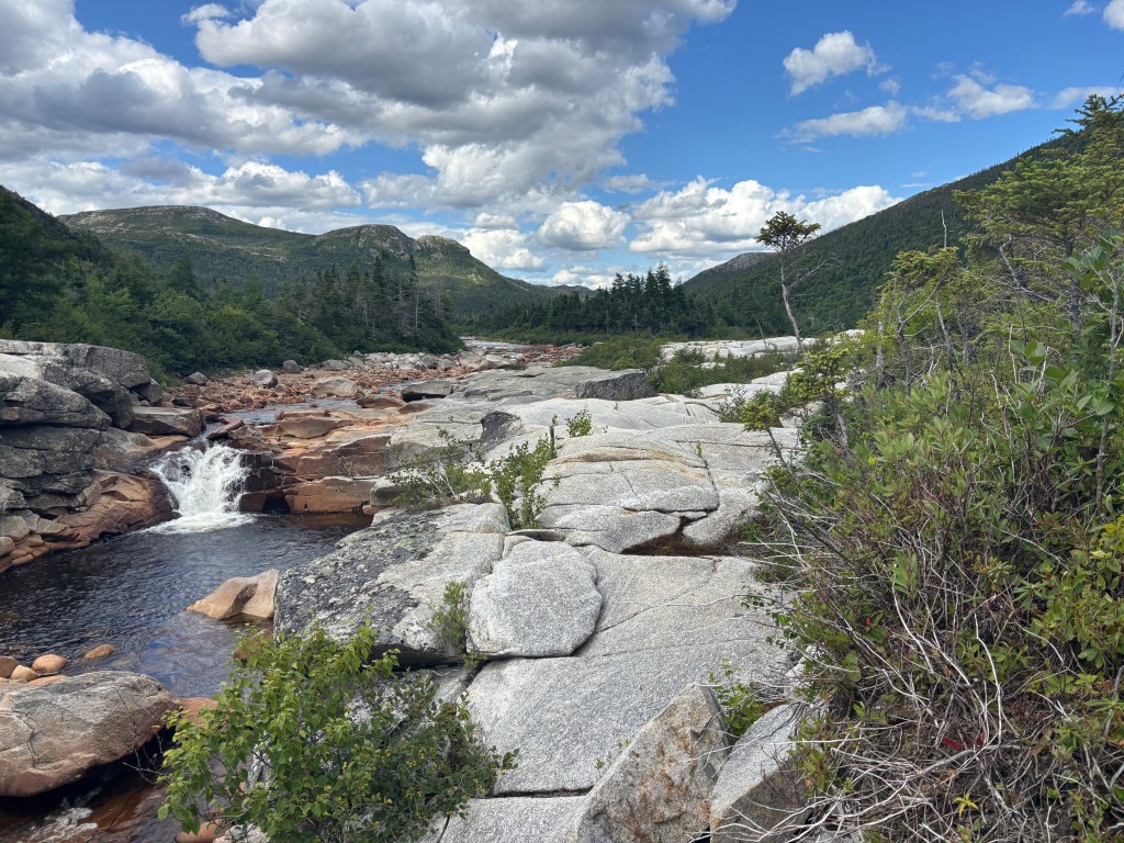
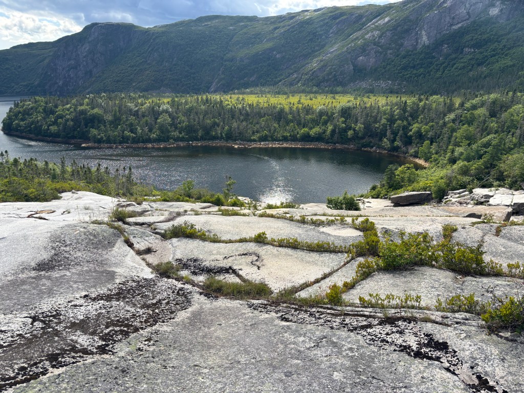
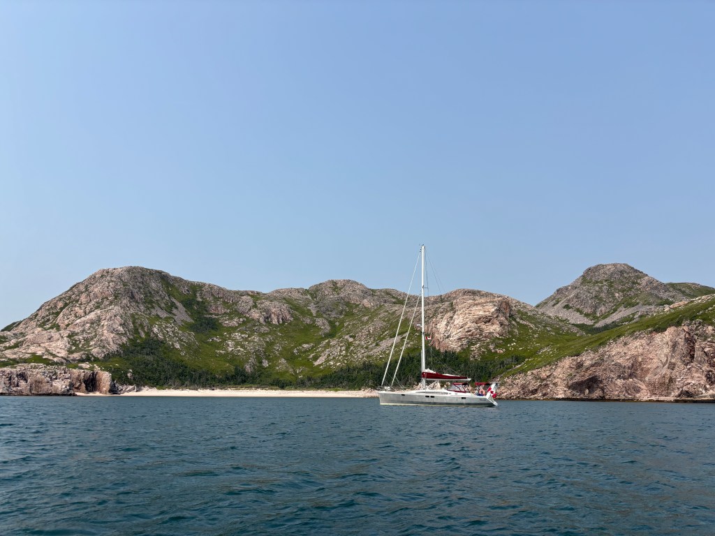
Being in a fjord, the land has a huge effect on wind direction, so despite having the prevailing southwest wind as we did all the way up the fjord, the wind at Sandy Pt Bay was east. So we anchored bow east and lowered the dinghy to explore. The fjord’s northeast arm, Morgan’s Arm, had a wide waterfall that must be amazing in the Spring. This summer has been dry in Newfoundland (also winter had less snow) so river levels are really low. The falls were still impressive. The basin at its base was a calm pond rather than the reports of a bubbling cauldron and the cruising guide suggests the adventurous (and smaller) boats can anchor right at the base of the falls. We hiked up the falls, picking blueberries and deciding on our bathing pool for the next day! Hare Bay deserved the time to be explored, and we decided to stay, explore and rest for a couple of days.
As expected, the wind shifted back to the west southwest in the evening and we had to reset the anchor. We should have done this in the first place as the bay was large with a consistent 13m depth, so giving enough swing room for most wind – live and learn. Around dinner time, another boat came into the bay but motored right past us into the next east bay with 5m depth. The boat looked really familiar! It was Ed O’Reilly, a local, and we had been watching his Newfoundland sailing videos as prep for this trip! Ed came around to say hello the next morning and he joined us for dinner on Tikaani where we shared sailing stories, some of which were true.
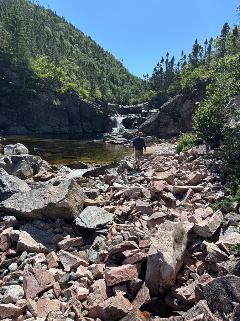
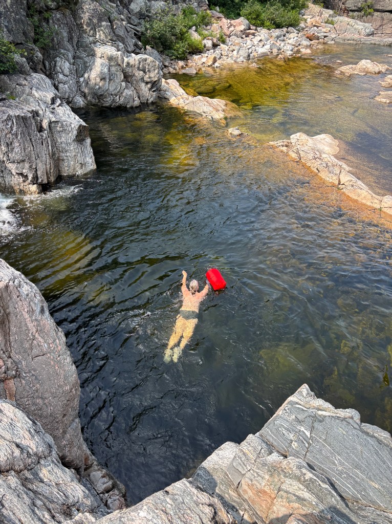
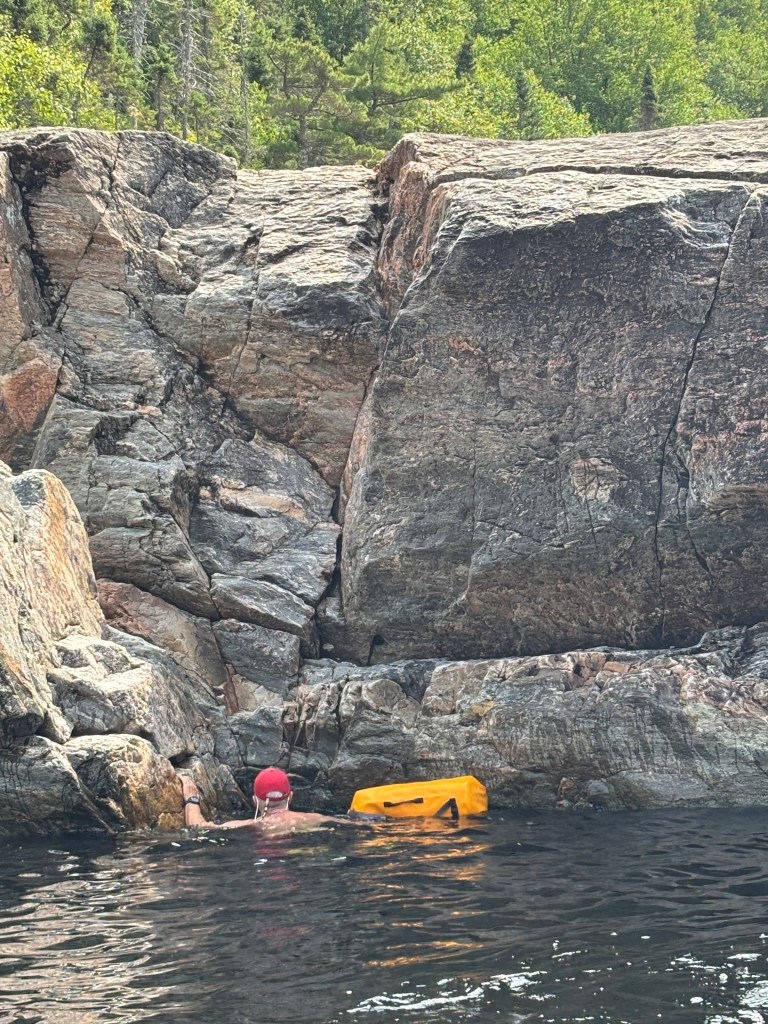
There were 2 smaller bays further east with Dollard Creek at the top. Dollard was tricky bouldering – slippery, flat and small rubble. Then we found another waterfall which was easier to climb and had many tiers of wading pools. We spent a glorious day bouldering, picnicking, swimming in fresh water! In Spring this stream must have been massively powerful as it is a monster boulder field. We were able to hike up the first couple of ponds before the shoreline got too steep, then had to resort to “canyoneering” where we would swim across the ponds and clamber up the cliffs on the other side, pushing our dry bags ahead. Coming back downstream was easier as you could just heave your pack off the cliff into the lower pond and jump!
Friday August 8
We set off west with a couple of potential locations in mind – none too far. We passed ‘Blow Me Down’ cliff – a massive ‘boulder’ 750m high. As we passed the town of Francois, we looked down the bay and saw several sailboats already on the dock, so that was a pass. Our target was Cap La Hune, with some options for anchoring. Our AIS indicated that another boat was in Deadman’s Bay which is exposed to the southwest – not desirable in at SW wind. We diverted to Wild Cove on the east side of Cap la Hune and felt we had won the anchoring lottery. Good holding, good depths and spectacular scenery.
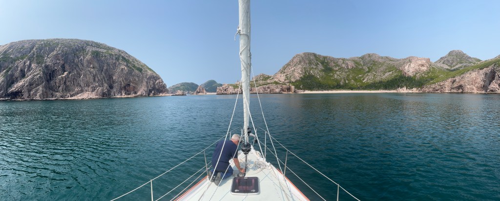
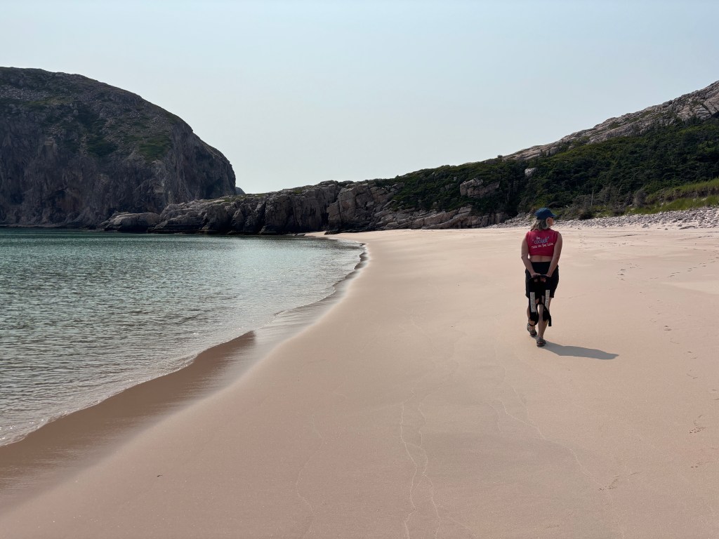
Wild Cove is completely open to the SW, surrounded on two sides by towering cliffs, boasts a waterfall and, to the north, is a most extraordinary white sand beach. The winds even cooperated, staying very soft from the west providing a beautiful, sheltered bay. The 300-foot-long south-facing beach was shallow for dinghy landings with fine, warm sand – as nice as any Caribbean beach we have been to.
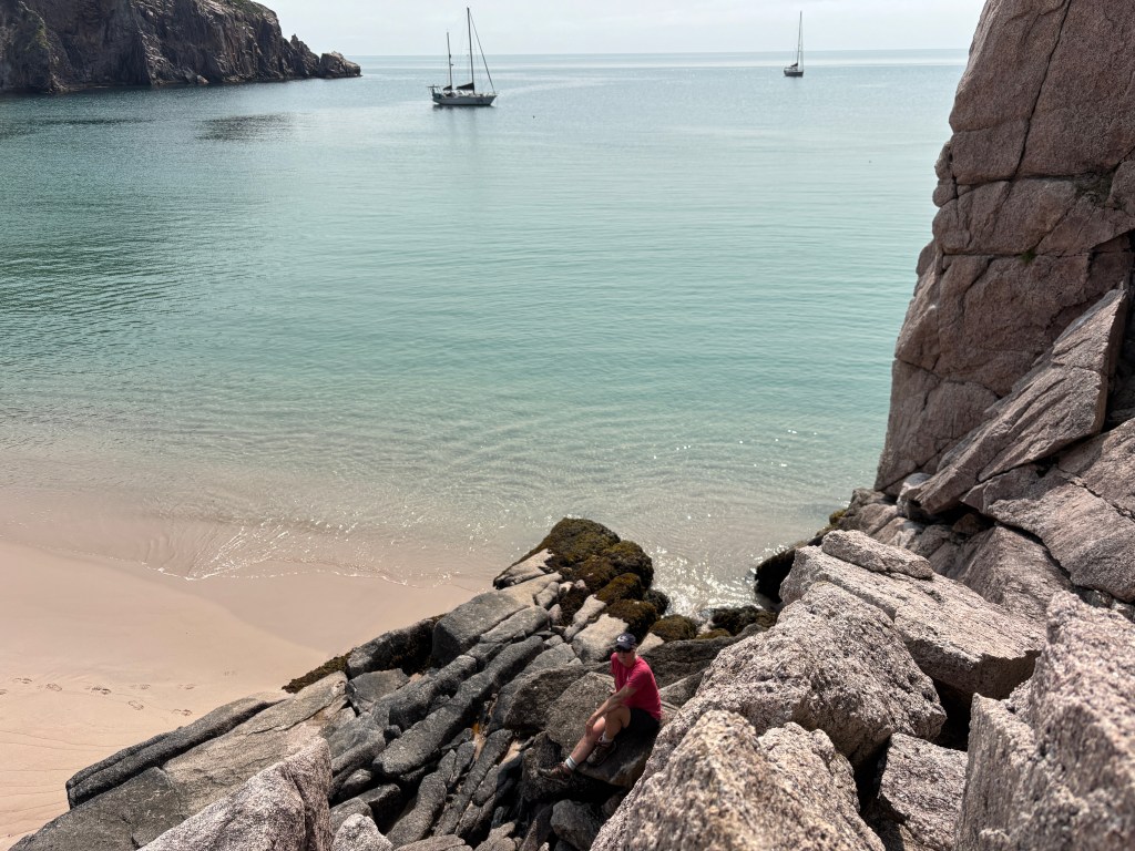
As dusk another sailboat dropped anchor just inside of us in the bay (two visitors in 2 days … we must be entering the tourist zone). We met Americans Matt, Rachel and their one year old son, on an Amel Maramu which they had been living on for the 3 years and had sailed north from the Bahamas for the summer. We shared anchorage recommendations and swapped books
The next morning we decided to see if we could scramble/climb up the cliff to what must be a pond or lake feeding the nearby waterfall. We tried several routes but the cliffs turned out to be too steep or too wet, or too vertical! Let’s face it… no hospital for miles and we are over 60… so best not to risk it. Still fun to boulder/climb and use the muscles!
Insert pic
Plans are to continue East, winds look benign for the rest of the week so will be motoring for ~3 hours between gorgeous anchorages!

Leave a comment